Step 2: Assess Vulnerability and Risk
Step 2: Assess Vulnerability and Risk
For this step, you will explore the climate change scenarios, impact, and risks for your heritage site. Scenarios could include forest fires, drought, flooding, increased snowfall, rising sea levels, and increasing stronger winds. Impacts for flooding, for example, could include water damage, mudslides, debris build-up, and foundation instability and erosion. Conversely, drought can increase the likelihood of pests and other animal intrusions, which can harm heritage buildings and artefact collections.
We have provided a risk assessment matrix to assist you in determining the likelihood and consequences of each impact, which will help you to prioritize which vulnerabilities should be addressed first.
Jump to:
Introduction: Climate Adaptation – Framework and Implementation
Step 1: Building a Strong Foundation
Step 2: Assess Vulnerability and Risk
Step 3: Identify and Select Adaptation Options
Steps 4 and 5: Implement Adaptation Actions, Monitor and Evaluate
Climate Adaptation Worksheet – download
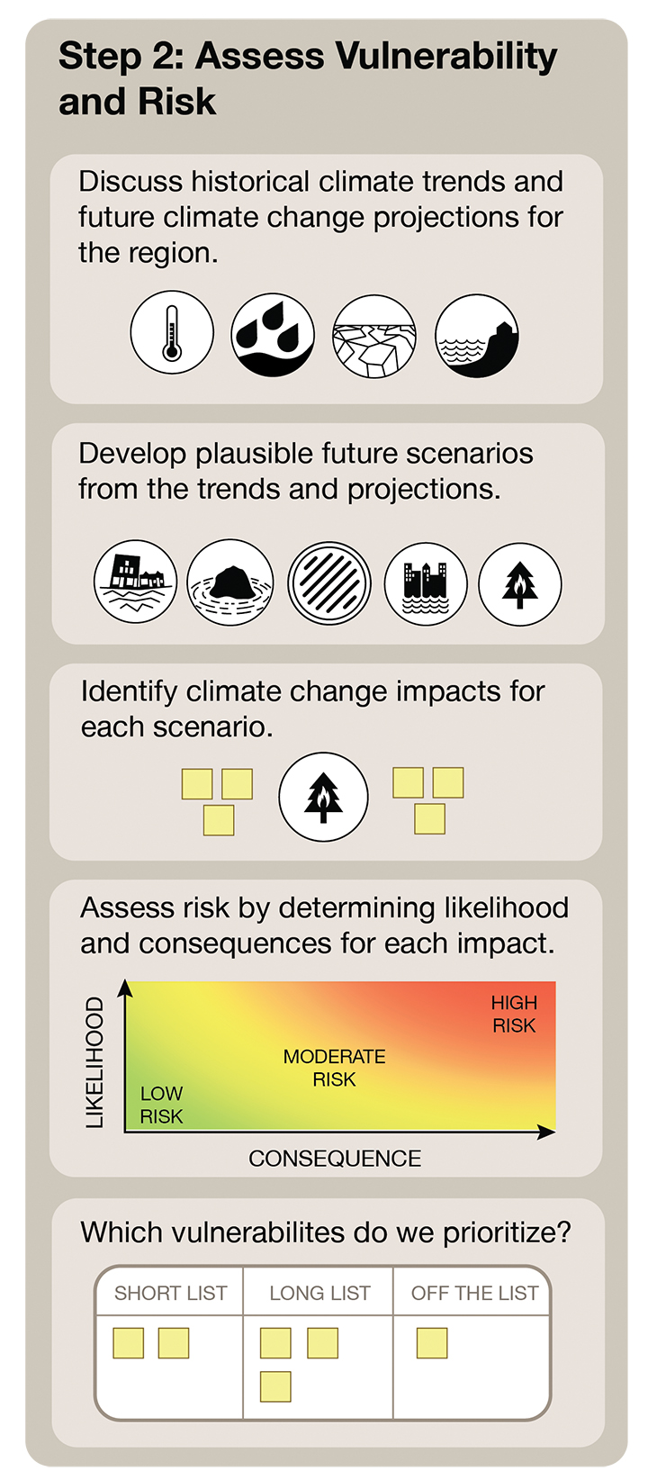
Discuss historical climate change trends and future climate change projections for the region.
- Look at data from sources such as Environment and Climate Change Canada (link)
- Examine records for your site if that kind of record keeping is done. If it isn’t, consider instituting it.
- Talk to stakeholders, Knowledge Keepers, and elders. Ask them about the trends they have noticed over time. Discuss what future projections they see for the region based on their knowledge and experiences.
- Other helpful sites
- Retooling’s Regional Projections and impacts (link)
- Province of BC, Climate Change in BC (link)
- Climate Atlas of Canada (link)
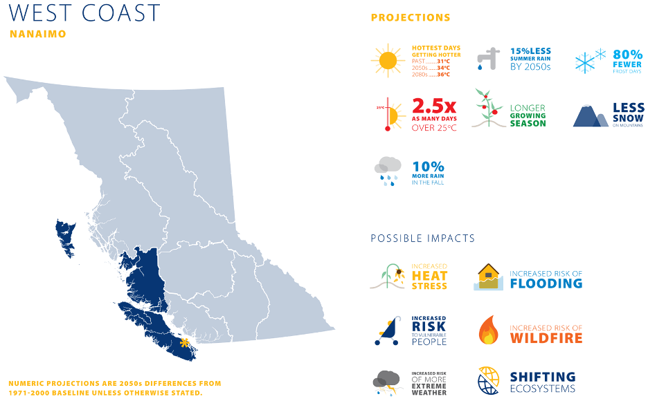
- Look for information that has been prepared specifically for your area. For example, the Capital Regional District has prepared a Climate Change Indicators report (here) and a Coastal Flood Inundation mapping project (here). The Regional District of Northern Okanagan has prepared a projections report (here), and the Fraser Basin Council has prepared a report specifically for BC’s Northeast (here). The Columbia Basin Trust offers online information (here) and, with Selkirk College, has developed the Columbia Basin Climate Source (here). UBC presents analyze of how climate envelopes will shift in the future (here).
Develop plausible future scenarios from the trends and projections.
- Based on the trends and projections for your area, what are the plausible future scenarios? Consider all seasons and immediate, medium- and long-term scenarios. Account for the potential of domino effects.
- Review the projections for your area and consider the potential impacts to your historic site. For example, what will it mean to your site if your area experiences a 10% increase in rainfall in the winter but 15% less rain in the summer?
(source)
Identify climate change impacts for each scenario.
- What will occur as a result of each scenario? Think through immediate-, medium- and long-term impacts, and the potential of domino effects.
- Impacts can be large, such as the site burning to the ground, or comparatively small, such as ash and smoke residue damaging surfaces.
- Don’t forget to refer to local studies and resources, as mentioned above. A lot of this work is likely already available to you.
Assess risk by determining the likelihood and consequences for each impact.
- How likely is each impact to occur? Does one occurrence increase the likelihood for the impact to recur? How do impacts affect each other? For example, forest fires can increase the chances of flooding the following spring.
- What are the consequences for each impact? Think about both immediate-, medium- and long-term consequences.
Which vulnerabilities do you prioritize?
- Which impacts are the likeliest to occur?
- Which impacts are likely to occur soon?
- Which impacts have the greatest consequences?
Step 2: Charting Vulnerabilities and Risks
We have prepared three simple-to-use charts to help you capture information and visualize what you need to do.
Start with the first tab to capture information from your research and record your thoughts and experiences. Share the chart with others so that you can fully describe the situations.
The second tab will help you to explore the situations more fully. Here, you will record trends, mitigations, assignments, and priorities.
On the third tab, you will complete the risk matrix based on the information you captured on the second tab. This chart will help you to visualize your most urgent risks and, most likely, your first priorities.